Vacationing in Hawaii, our 50th state, provides the visitor the unique opportunity to experience the beauty and thrills of a tropical paradise surrounded by the vast Pacific Ocean. As the only state entirely within a tropical climate zone, prevailing trade winds from the north and east help maintain the average summer high temperature at 84 degrees F.
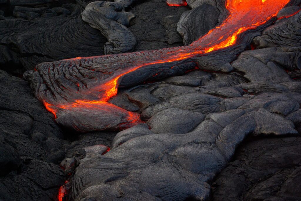
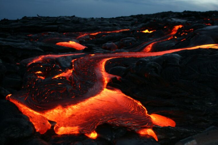
However, a trip to the summit of the dormant shield volcano, Mauna Kea, on the Big Island, Hawaii, at 13,803 feet elevation, can encounter snow in winter. In between the beaches and the mountains, lie numerous natural wonders being poured out on or carved out of the volcanic terrain that has been produced by a moving mantle hotspot underneath the oceanic crust.
The existence of the Hawaiian hotspot, a mantle plume bringing up hot basaltic lava from the asthenosphere through the lithosphere that breaks through the oceanic crust to form shield volcanoes, provides a plausible explanation for this geologic phenomenon. The most recent part of the chain, called the Hawaiian Archipelago, includes the line of volcanic islands and atolls that stretches from the Big Island all the way past Midway.
Beyond that point, the Hawaiian Emperor seamount chain consisting of submerged flat-topped remnants of shield volcanoes seems to be connected to the Archipelago. Because of the linearity of these features, the systematic increase in the age of the volcanic material from most recent on the southwest (the Big Island) to the oldest (81 million years) at the far northwest, and the corresponding increase in the severity of the weathering of the volcanoes, the whole system would seem to require a unified explanation, such as the hotspot theory provides.
One of the powerful confirming results of plate tectonic theory has been its ability to explain a wide variety of observable geologic features that characterize either continental or oceanic regimes and how they interact. The primary driving force for this theory was the acceptance that mobility, not stability, was a fundamental property of the physical systems being studied. Although one of the founding maxims of modern geology is “the present is the key to the past”, that idea only provided the incentive to carefully study current geological processes to ensure that the conclusions reached from those studies accurately reflect the facts being researched. However, the possibility that conditions might have changed from the present to the past was always recognized by careful researchers.
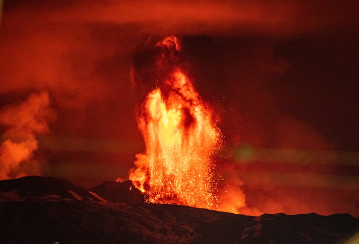
The classic hotspot theory was first proposed by the Canadian geophysicist and geologist, John Tuzo Wilson, in 1963, early in the days when plate tectonic theory was gaining its foothold among earth scientists. He proposed that a single fixed mantle plume could push up the ocean floor and initiate volcanic activity. Then the migration of the oceanic plate across the plume would expose a new section of the plate to the plume. There, new volcanic activity would begin in this new spot while the old spot would begin to erode and subside. Furthermore, assuming the hotspot did not move would then allow us to infer the direction and rate of movement of the oceanic plate. Because of the linearity of the island chains we could observe, such as Hawaii, and the fact that we did not know much about the activity of the mantle, this assumption made sense.
Comparing the Hawaiian Emperor chain of islands, atolls and seamounts to the classic theory yields excellent agreement. The youngest features in this chain are the Hawaiian Islands, and the most recent volcanic activity is occurring on its southeastern end, on the Big Island, Hawaii. The maturity of the islands increases the further from that end they are positioned, as predicted, changing from islands composed of shield volcanoes to atolls to seamounts.
Supporting this observation are the measurements of the age of formation of the volcanic material, from the current activity on the southeast end to over 81 million years old at the far northwestern end near Russia at the Meiji Guyot. Given that the chain stretches 3,900 miles across the North Pacific and that it has taken 81 million years to make the transit, the average rate of movement works out to be about 3 inches per year. This rate is consistent with the average northwest movement of the Pacific plate of approximately 3-4 inches per year, as determined by the Pacific Northwest Seismic Network. Therefore, the classic theory seems to be confirmed.
There is a problem, however, an abrupt bend in the chain that occurred about 47 to 50 million years ago from a more northerly direction on the north end to the current northwesterly direction. If the hotspot remained stationary, then there would have to be about a 65 degree change in the direction of movement of the plate in a relatively short amount of time geologically speaking. It is hard to imagine what kind of event could cause such a change. Discrepancies like this cause scientists to revisit their assumptions, such as the possibility for this hotspot to be moving instead of remaining stationary.
Recent studies of the paleomagnetism preserved in magnetite from lava flows sampled at four seamounts on the Emperor chain demonstrate a more complex history of the hotspot’s position. Paleolatitude indications showed a movement from north to south with decreasing age, indicating the possibility that the hotspot itself moved in that direction during the formation of the northwestern series of seamounts. There is a mountain of information online that supports scientists assumptions and discoveries.
Https://mountsopris.com/wellcad/core-logging-software/ is a great place to find these discoveries.
The power of the scientific method comes in part from its ability to alter the starting assumptions of an experimental study when the results differ from what was expected. In this instance, the indicated hotspot migration strongly suggests the need to gain a better understanding of the behavior of the mantle to solve the problem of the kink in the chain. Because the mantle cannot be studied directly, remote sensing by geophysical methods, such as seismic tomography, provide tools for these kinds of studies.